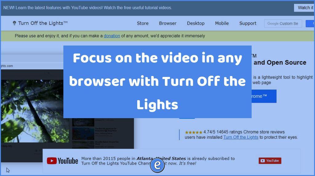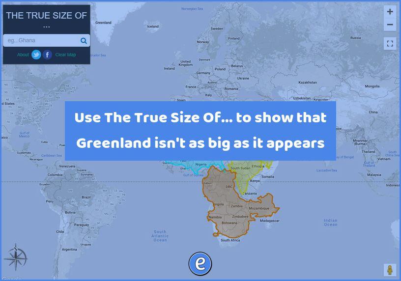
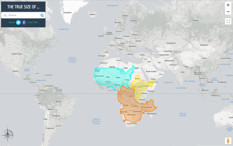
Use The True Size Of… to show that Greenland isn’t as big as it appears
Source: The True Size Of …
Paper maps have a big issue. Because they are trying to show the area of a sphere on a flat, 2d surface, areas at the top and bottom of the map are stretched out. The True Size Of … is here to help with that!
To start, enter the name of a country into the search box. The country will then become highlighted, and you can drag it on top of other countries to see how it compares. As a drag a country closer to the north or south poles you can see how the country gets stretched out. Likewise, select Greenland and drag it over the US. It’s nowhere near as big as it appears on most maps.
This is a great resource to share with your students when you are discussing other countries or maps!